
Project Overview
Click to enlarge
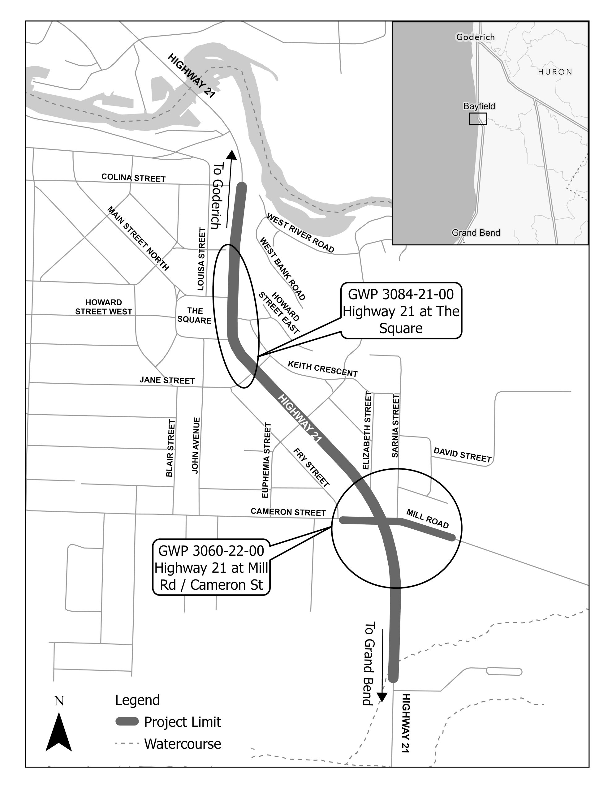
The Ontario Ministry of Transportation (MTO) has retained Parsons Inc. (‘Parsons’) to undertake the Detail Design and Class Environmental Assessment (EA) Study (the Project) for intersection improvements on Highway 21 at Mill Road / Cameron Street and ‘The Square’. The Study Area is located within the Community of Bayfield in the Municipality of Bluewater and County of Huron. The proposed improvements include the implementation of a signalized intersection at Highway 21 and Mill Road / Cameron Street, and the installation of a new pedestrian crossing along Highway 21 near The Square.
These improvements are required to optimize the existing transportation infrastructure and meet safety and operational needs. As part of the EA process, the Project Team will review design options and develop the detail design for the signalized intersection and pedestrian crossing.
This Project is following the approved planning process for a Group ‘C’ project under the Class Environmental Assessment (Class EA) for Provincial Transportation Facilities and Municipal Expressways (2024). Consultation will be ongoing throughout the project. A Transportation Environmental Study Report (TESR) will be completed to document the EA process, consultation undertaken, existing conditions, design options, the Recommended Plan, environmental impacts and mitigation measures. The TESR will be made available for a 30-day comment period.